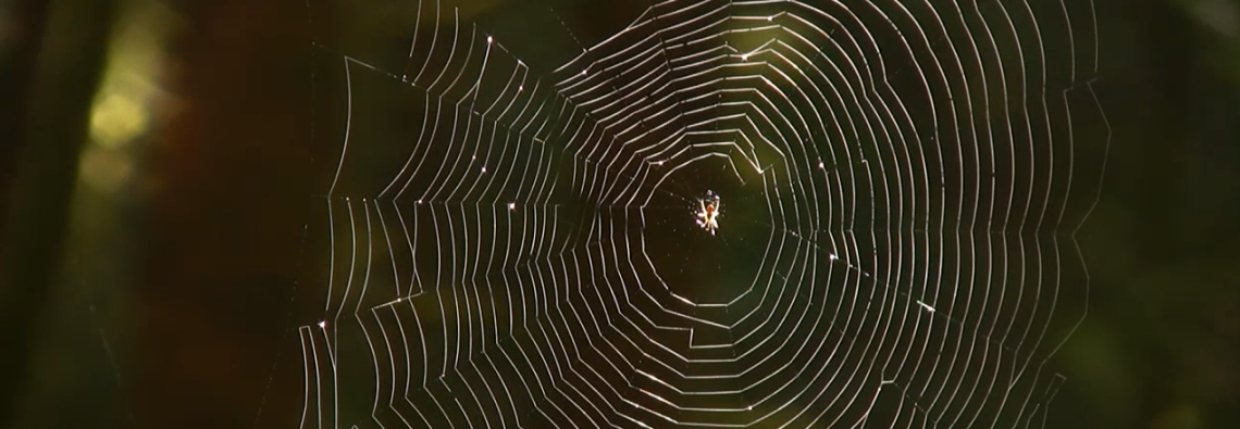

University of Idaho professors and a group of German scientists used LiDAR data to map spider habitat within the Bavarian Forest National Park in Germany.
University of Idaho professors Lee Vierling and Kerri Vierling collaborated with a team of German scientists to study ecosystems using remotely sensed laser data. The research team used LiDAR data collected from aircraft to create 3-D pictures of the different forest layers in Germany’s Bavarian Forest National Park. By combining LiDAR data with extensive field data about spiders and other information about an area’s vegetation, rainfall patterns and temperature, researchers can get a detailed picture about the habitat characteristics important to a healthy spider population.
“Spiders are the dominant invertebrate predator in many land-based ecosystems. Often, they are beneficial to humans by eating insects like mosquitoes and agricultural pests,” explains Lee Vierling. “An area’s spider species composition can be sensitive to vegetation structure, soil moisture and disturbance, and can indicate the overall level of ecosystem health. The laser data acts like an MRI of the forest, which allowed us to predict where a number of spider species live across that broad landscape.”
“LiDAR is an awesome technology that takes us away from little individual plots where we measured a few spiders,” said study co-author Lee Vierling, an University of Idaho ecologist who specializes in using remote sensing to study ecosystems. “It allows us to zoom out to the entire landscape.”
Spiders are the dominant invertebrate predator in many land-based ecosystems. Often, they are beneficial to humans by eating insects like mosquitoes and agricultural pests. An area’s spider species composition can be sensitive to things like vegetation structure, soil moisture and disturbance, which makes them good indicators of overall ecosystem health.
Usually, scientists must trek into the field to study the resident spider community. But these ground-based studies only give information about the limited areas scientists can reach on foot.
“In woodland, you are usually confined to the ground, which cramps your style given that most of the structure is way out of reach above your head,” wrote Shelley Hinsley, an ecologist with the Center for Ecology and Hydrology in the United Kingdom, who was not involved in the LiDAR mapping work.
By using LiDAR, not only can scientists cover more ground with an aerial survey; they can study habitats high up in the forest canopy. By combining LiDAR data with other information about an area’s vegetation, rainfall patterns and temperature, researchers can get a detailed picture about the habitat characteristics important to a healthy spider population.
In a study published in the March Ecological Applications, Vierling’s team used LiDAR to create 3-D pictures of the different forest layers, including the canopy and ground vegetation, in the Bavarian Forest National Park. They mapped the terrain, and measured how much sunlight certain areas got and where moisture accumulated.
From those measurements, they predicted what species of spiders ought to be present in different habitats. Then they checked the predictions with ground surveys, counting and measuring vegetation types and spider presence.
Even though the two techniques measured different aspects of the forest, Vierling and his colleagues found their LiDAR measurements were as reliable as a ground survey at predicting the presence of spiders and types of species present.
But there are limitations. While LiDAR could predict which spiders ought to be in a certain area, it wasn’t good at predicting how many individual spiders there were. A scientist would still have to go in on foot if they wanted to find that out.
However, “in this case, now we can make maps with a known amount of confidence that certain types of spiders would most likely be in certain parts of this national park,” said Vierling.
“This is a highly innovative study,” wrote Greg Asner, a researcher at the Carnegie Institution for Science at Stanford who wasn’t involved in the study. “I think it’s a great example of the power of 3-D remote sensing for ecological research.”
Sources:
Wired Magazine
University of Idaho