With several new lidar datasets becoming available, now is the time to discuss factors associated with lidar adoption, risk perceptions, experience, and other structural constraints.
Conducted Thursday, October 15th, 2020
12:00-1:00pm MST
Presented by: the Human-Environment Systems Research Group and the Boise Center Aerospace Lab at Boise State University, and on behalf of the Idaho Lidar Consortium.
Acknowledgments: FEMA Region X, the Idaho Lidar Consortium, and Boise State University’s Human-Environment Systems Research Group, and the Hazards and Climate Resilience Institute.
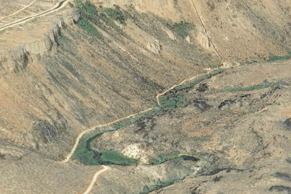
Boise River Flood Control District #10 (FCD10) is developing a 2-dimensional (2-D), HEC-RAS hydraulic model capable of steady or unsteady flow analysis of the Boise River channel and floodplains. The model will generally cover the Boise River corridor from the confluence with the Snake River upstream to Diversion Dam, near Lucky Peak Reservoir. The hydraulic model will serve as the foundation for the Boise River Management Tool (BRMT), which is intended to be utilized in the planning-level assessment of flood risk, development impacts, and environmental impacts. The BRMT’s primary function will be to assist in the evaluation of existing conditions and potentially a range of alternatives available for upcoming projects.
Development of the BRMT requires capturing the current river topography through bathymetric LiDAR prior to developing a hydraulic model to predict water depths and velocities, both in the channel and on the floodplain under various flow conditions. This tool requires an accurate, detailed, and seamless survey of the ground surface, channel bathymetry, and structures as the basis for developing the tool.
FCD10 is inviting qualified companies to respond to this Request for Proposal for the specific task of LiDAR Data Acquisition and Post-Processing for an approximate 61 mile reach of the Boise River in the Treasure Valley, Idaho.
Technical Contact and Contracting Representative:
Mike Dimmick, District Manager
Boise River Flood Control District #10
Email: Projectmgr@boiseriver.org
Phone: 208 861 2766
Critical Dates:
Request for Clarification Deadline: October 4, 2019 – COB
Response to Clarification Deadline: October 8, 2019 – COB
Proposal Submission Deadline: October 15, 2019 – 4:00 pm MDT
Greg Asner used a golden sensor to measure the density of the leaves, their levels of essential nutrients like nitrogen, water, calcium, phosphorus, and their levels of two defensive chemicals—lignins and polyphenols. And by using machine-learning algorithms to interpret these seven traits, he has shown that the Amazon can be divided into 36 distinctive types of forest, which fall into six major groups.
We are seeking candidates for a part-time Technical Coordinator for the Idaho Lidar Consortium. We are accepting candidates who are interested in developing a multi-year lidar acquisition plan and promoting and initiating multi-agency lidar data collections in the State of Idaho. The full job description and instructions for applying can be found here.
Good news – the Idaho 3DEP proposal, Multi-hazard Risk Assessment and Ecosystem Restoration in Idaho: Nez Perce Tribe, Nez Perce County, and Clearwater Watershed, has been recommended for funding!
Special thanks to the following people who made this happen:
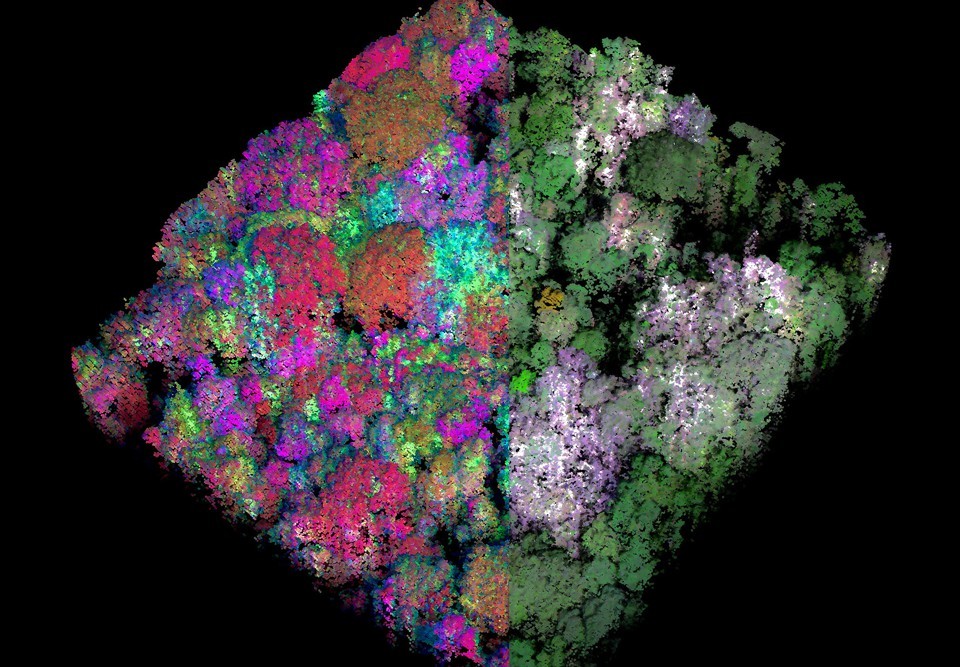
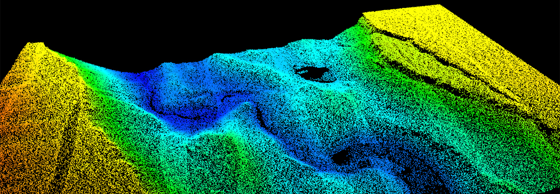
LiDAR point clouds from a landslide near Salmon Falls, Idaho
LiDAR point clouds from a landslide near Salmon Falls, Idaho
The National Science Foundation awarded a $320,000 grant to develop software tools to analyze LiDAR data.
The collaborative research is led by Nancy Glenn (Idaho State University’s Department of Geosciences Boise Center Aerospace Laboratory), Andrew Hudak (U.S. Forest Service Rocky Mountain Research Station), and Joe Wheaton (Utah State University) and in partnership with Open Topography.The project will run three years.
The software tools will be available for free on the NSF-funded OpenTopography supercomputer at the UC-San Diego Supercomputing Center and on Google Code. The new tools will also give student researchers easier access to point-cloud data.
“We expect that hundreds of new users will employ and benefit from these tools based on the existing user base, enhanced exposure provided by integration into OpenTopography, and the growing ease of acquisition and interest in 3-D point-cloud data,” said Glenn.
The grant, awarded in fall 2012, builds on the work of BCAL postdoctoral researcher Rupesh Shrestha, Ph.D. Over the past three years, he has developed similar tools to help undergraduate and graduate student researchers at multiple universities around the world to analyze 3-D data from LiDAR, a remote-sensing technology that generates 3-D point-cloud data.
For more information, contact Nancy Glenn at 208-373-1819 in Boise.
Making Point Clouds Useful for Earth Science: This collaborative project between Idaho State University (ISU), Utah State University (USU), and USFS Rocky Mountain Research Station (RMRS) will develop the next generation of analytical and processing tools for new airborne and ground-based LiDAR monitoring data. The tools will help earth scientists and natural resource managers exploit these data streams to address some of our most pressing environmental questions and management challenges. The software tools will target Earth Science-specific analysis of 3-D point cloud data from platforms like airborne LiDAR (ALS), ground-based LiDAR (TLS), multi-beam SONAR (MBS), and/or Structure from Motion (SfM). The tool development will scale-up existing documented and proven algorithms to be more accessible, as well as build new algorithms that are necessary to address emerging challenges such as change detection analysis from repeat surveys, improved bare earth surface generation, and novel fusion of point clouds collected from different platforms (e.g. ALS and TLS). The new software will be developed collaboratively between geoscientists and computer scientists to optimize performance when handling the large and often problematic data volumes associated with point clouds. This work will provide a suite of community software that will permit innovative and potentially transformative data analysis with the potential to enhance our understanding of numerous earth surface processes.
IQ Station at Idaho State University, Boise Center Aerospace Laboratory (BCAL)
IQ Station at Idaho State University, Boise Center Aerospace Laboratory (BCAL)
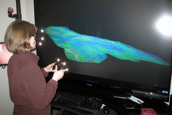
Boise Center Aerospace Laboratory (BCAL) is developing new methods to visualize and interact with LiDAR remote sensing data using 3D-IQ Station
Idaho State University, Boise Center Aerospace Laboratory (BCAL) is developing new methods to visualize and interact with hyperspectral and LiDAR remote sensing data. As these data are becoming increasing complex, new methods for fusing and interacting with the data are necessary for leveraging their multidimensionality. With a new immersive
3D system resulting from a collaboration between Idaho Universities and the Idaho National Laboratory (INL), scientists can explore multiple dimensions of data that, until now, could only be viewed two dimensionally.
A traditional IQ-Station (also known as CAVE™) is housed in a room with projectors displaying images on all surfaces, while cameras are used to track the movements of the user. The user wears 3D glasses and operates a controller to view and interact with data in a 3D immersive environment. ISU’s IQ-Station displays images on a large screen instead of on the walls. The user can interact and manipulate the data across a volume or area projected on the screen. IQ-Stations are portable and less expensive than full CAVE™ systems, and can be useful in many applications where full-featured CAVE™ systems are not needed.
The IQ-Station at ISU BCAL features a 3D 73-inch Mitsubishi LCD display and optical tracking system by NaturalPoint and relies on a high end computer to run Vrui, a virtual reality software developed by UC Davis that performs the 3-D rendering. In addition to remote sensing data, MRI and CT scans (medical imaging), CAD drawings (engineering), and complex molecular diagrams (chemistry) can also be visualized in the IQ-Station for scientific interaction.
The IQ-Station at ISU BCAL is currently being used for several research projects. These include a multi-temporal study of an active landslide located in the Salmon Falls area 16 miles south of Hagerman, ID, and a line of sight study to aid visual studies under forest canopies for artificial intelligence and landscape modeling.
INL has also donated IQ-Stations to Boise State University and University of Idaho.
Idaho LiDAR Consortium and FEMA has prepared a specifications for LiDAR and other high quality digital topography data
Beginning in Fiscal Year (FY) 2010, Federal Emergency Management Agency (FEMA) initiated a five-year program for Risk Mapping, Assessment, and Planning (Risk MAP). FEMA’s vision for the Risk MAP program is to deliver quality data that increases public awareness and leads to mitigation actions that reduce risk to life and property. To achieve this vision, FEMA will transform its traditional flood identification and mapping efforts into a more integrated process of accurately identifying, assessing, communicating, planning for, and mitigating flood risks. FEMA Standards For Lidar And Other High Quality Digital Topography